Introduction to a Huge Issue for Iowa
With newly located data, it can now be stated with certainty, that all
citizens who value Iowa's rich landscapes and small remaining patches of
wildlife habitat, will need to pay very close attention to what industrial
strength strip mining for frac sand does to the land surface, and to what
fracking does to subsurface resources including essential groundwater aquifers
where more than 90% of Iowans obtain their drinking water.
There are no rules or regulations at the state level,
nor within any county that we are aware of, which address: 1.) Test drilling
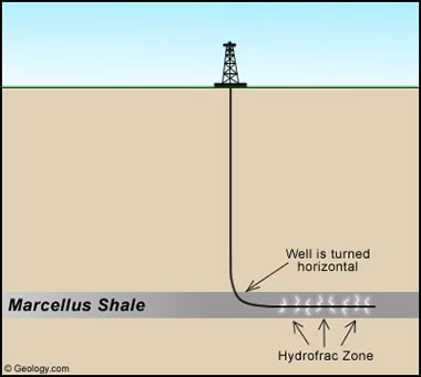
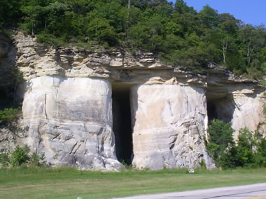
deep into vital groundwater aquifers (Jordan and St. Peter Sandstone
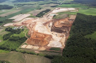
Formations); 2.) Removing entire landscapes during the strip mining process for
frac sand; 3.) Fracking (hydraulic fracturing) of vital underground aquifers;
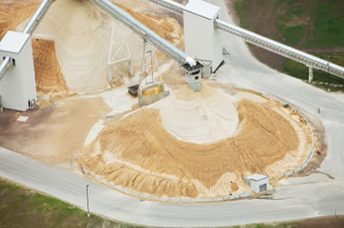
4.) Frac sand processing facilities that traditionally use a million gallons of
water per day of operation; 5.) Transporting frac sand on small to large roads
and highways; and 6.) Health concerns stemming from such new issues as
carginogenic fugitive silica sand dust, spillage of chemicals directly into
exposed groundwater aquifers, and other as yet unidentified issues.
Until now we (in Allamakee and Winneshiek Counties) thought we were
essentially alone in seeking to prevent the destructiveness of frac sand mining
(as Clayton County had already capitulated to the whims of these miners at a
grandfathered in mine). But with the data I will distribute tonight, it will
become obvious that scores of county governments and the state legislature will
have to become directly involved in entirely new ways of protecting the health
of Iowans, our state's natural resource base, and the quality of life we
cherish.
Please scroll to the bottom of this page for quick and obvious visual
lessons on this topic.
This is the first of three brief emails. Each covers specific aspects of
this issue.
Thank you.
Ric
Ric Zarwell, President
Allamakee County
Protectors - Education Campaign
P.O. Box
299
210 North Third
Street
Lansing, Iowa
52151-0299
Email: Ric.Zarwell@mchsi.com
Home/Office:
563-538-4991
Mobile:
563-419-4991
The world is a dangerous
place to live; not because of the people who are evil,
but because of the people
who don't do anything about it. Albert
Einstein
If
not now, when? If not us, who? John F. Kennedy
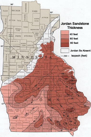
THE MAP near the bottom of this page reveals WAY
MORE FRAC SAND in IOWA than had been expected before. And thus, a lot more
danger than previously realized!!
|
No comments:
Post a Comment